New in gINT 8.1
gINT SoftwaregINT is the leader in software for Geotechnical and Geoenvironmental data management and reporting with over 7,700 licensees in 68 countries. Datgel is an authorised global reseller of gINT. As of 2026, gINT can only be sold to accounts/companies that hold existing licenses.
| ||
From point solutions to systems customized to your requirements, leverage Datgel's advanced knowledge and experience with gINT:
|
|
gINT Version 8.1 - New Features
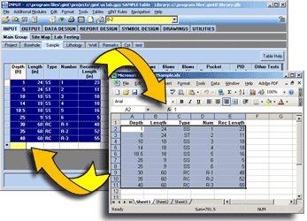
Version 8.1 has been redesigned at every level, offering expanded capabilities in exporting, scripting, table and records creation, and more. Even our outstanding gINT Rules programming functionality is better than ever, with expanded properties, methods, events and documentation.
gINT Version 8.1 now has:
| ||
 | ||
| ||
 | ||
| ||
| ||
 | ||
| ||
 | ||
| ||
| ||
 | ||
| To View a complete list of all the new features available in gINT Version 8.1 | ||
If you are an existing member, Log in here to access brochure